Nerja hike to the Colmenarejos stone arch. A low-difficulty route through a dry stream bed
Diario Sur describes an unofficial walking route in Nerja that follows the Colmenarejos stream to a naturally eroded stone arch in the Sierra Almijara.
By Costa del Sol Journal Newsroom · · AI-assisted
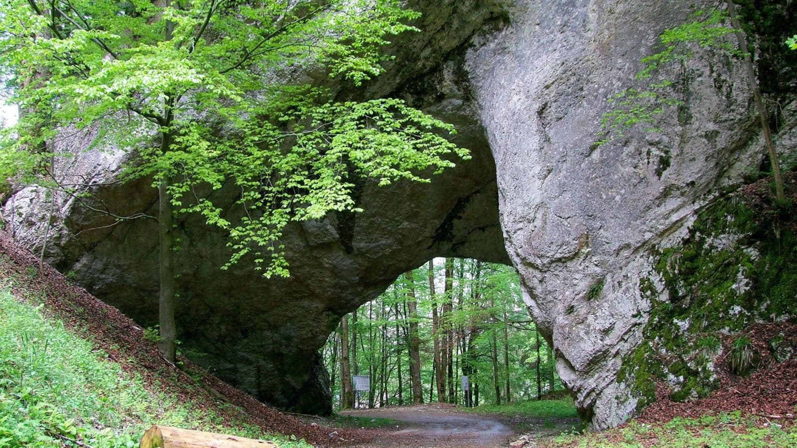
A popular walking route in the municipality of Nerja leads to the stone arch of the Colmenarejos stream, which Diario Sur describes as one of the most surprising natural formations in this part of the Sierra Almijara. The paper rates the walk as low in difficulty, though walkers need to take care on the stony stream bed.
Key facts
- Where: between the Acantilados de Maro-Cerro Gordo natural area and the Sierras de Tejeda, Almijara y Alhama natural park, in Nerja.
- Status: a popular path that is not officially approved (homologated) as a waymarked trail.
- Difficulty: low, according to Diario Sur, with caution needed on the pebbly stream bed.
- Stream section: about 1 km long, with the arch on the right after roughly 900 m.
- Route end: the arch; Diario Sur advises returning the same way.
Getting started
Diario Sur gives two options for the start. The first is from the hamlet of Maro, parking near the Hotel Playa Maro and walking about one extra kilometre beside the old N-340 road. The paper says this stretch adds little scenic interest.
The second option shortens the walk. Drivers continue east from Maro along the N-340 and turn onto the track to the Molino de Casanova (an old mill), then look for parking nearby. Diario Sur says parking must always be south of the A-7 motorway. Beyond the mill there are tracks and spaces where cars can be left, as long as they do not block the way.
The route itself starts at the bridge over the A-7, which serves as the reference point.
The route
Walkers cross the bridge northwards and follow an earth track, passing horse-breeding facilities on the left and subtropical crops on the right. This first stretch of about 700 metres is on concrete and dirt track and is described as comfortable.
The track then reaches the entrance of an old quarry, where signs forbid entry. According to Diario Sur, vehicles and machinery that were vandalised sat there for decades, and their removal began in 2025. The paper warns against cutting through the quarry: it is private property, and there is a risk of rockfall.
Just before the signs, a narrow path leaves to the left, marked with an arrow and green paint on the rocks. It climbs gently, then levels out. Over some 600 to 700 metres it gives views of the quarry and the cliffs, and Diario Sur counts it among the most attractive sections. The path then drops into the stream bed.
From there the route runs entirely along the usually dry, stony bed of the Colmenarejos stream, so there is little risk of losing the way. Diario Sur mentions a hard-to-reach cavity and, further on, a cave popularly known as the cueva de las Tres Puertas, set high up and also difficult to reach. Vertical rock walls and natural shelters line the ravine. Some may have been used as refuge in the past, but the paper says this is not documented.
The arch
About 900 metres into the stream-bed section, the arch appears on the right. Diario Sur describes it as a large rock structure pierced naturally, its opening the result of erosion over a long period. The paper calls it the main attraction of the outing.
The proposed route ends here. Diario Sur notes that walkers could continue up the stream bed to link with the Pico del Cielo trail, or head east past the arch towards the Río de la Miel valley, but these are unmarked, harder options and not part of the itinerary described.
Nature and nearby sights
The paper lists Mediterranean vegetation along the way, including Aleppo pine, esparto grass, rosemary, thyme, mastic, wild olive and savin juniper. Wildlife in the area includes the Spanish ibex, which may be spotted on high, steep ground, as well as foxes, wild boar and genets, and birds of prey such as Bonelli's eagle and the peregrine falcon.
Nearby places of interest named by Diario Sur include the old Colmenarejos quarry, the Cueva de Nerja, the hamlet of Maro, the Águila aqueduct and the Maro tower.
What to bear in mind
Because the path is unofficial, only informal markings exist, though Diario Sur says orientation is very intuitive and some unofficial signs help. Walkers should stay out of the quarry and take care on the loose stones of the stream bed.